
Geography
Introduction
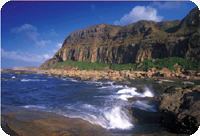
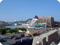
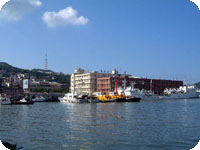
Keelung is situated in the northern part of Taiwan with Keelung Islet and Hoping Island as its natural defense and the harbor faces the Pacific Ocean. Keelung is the largest natural port in northern Taiwan with the harbor area reaches deep into downtown, a rare case among all the harbor cities. As a result, the development of Keelung Harbor is closely related to the business development and scenery of the city.
The city is surrounded by mountains with the exception of the harbor reach of Keelung harbor, which is a wind gap.
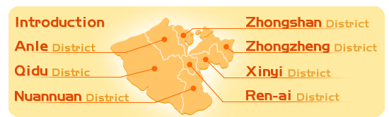
Keelung City is divided into seven districts, which are Zhongzheng District, Xinyi District, Ren-ai District, Zhongshan District, Anle District, Nuannuan District and Qidu District. Among the seven districts, Qidu District accounts for 42.38% of the city and is considered the largest district while Ren-ai District is the smallest one. The city also has 7 islets, including Hoping Island, Zhongshan Islet, Tongpan Islet, Keelung Islet,Pengjia Islet, Mianhua Islet and Huaping Islet. Each district and islet has its unique natural landscape and culture.
According to statistics calculated in late November 2015, Keelung City has a population of 372,355 people, and 9,136 (2.4%) of these residents are aborigines. Excluding tribal areas, Keelung City’s 2.4% ratio of aboriginal residents is quite high when compared to other areas in Taiwan. Furthermore, Keelung City enjoys Taiwan’s highest ratio of new immigrants. This group is on the verge of exceeding 10,000, as there currently are 9,969 new immigrants, accounting for 2.68% of the city’s population.
In Keelung there are 29 clan associations, which are a type of social organization where group members share the same last name. A total of 26 surnames have formed 15 clan associations with different last names. These associations take turns hosting ceremonies and events during the Ghost Festival that typically takes place in August or September. Another type of social organization is the province associations, which connect people who have ancestors that came to Taiwan from the same province in China. There are 34 of these associations in Taiwan, and they seek to forge friendships within the association and do work with planning meetings.
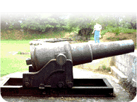
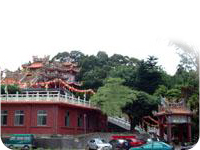
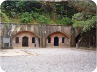
Looking back into the past, Spain, Holland, and Japan occupied or ruled over Taiwan for different periods of time. Not surprisingly, historic sites left behind by these former conquering countries can still be found here in Keelung. These cultural remnants add to the diversity of this city by the sea and how it embraces different cultures.

Zhongzheng District
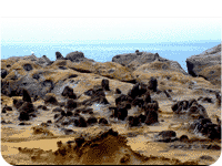
- This district is a long and narrow terrain, near to the ocean. It has more hilly land and less flat area. There is a long monsoon period and rainy season during winter.
- Located in the north side of this district, Heping Island is separated just by a river and facing Keelung Islet from a long distance, clutching the throat of Keelung Harbor.
- This district facing the Pacific Ocean in the north and covers Heping Island, Pengjia Islet, Keelung Islet, Mianhua Islet, and Huaping Islet, provided with enriched natural geographic landscapes.
- In the northeast, Badouzi borders on Ruifang Township, Taipei County. As an important path to Yilan, the Coastal Highway starts from this district.
- The terrain is long, narrow and mountainous. There are Xuqiu Mountain, Xin Mountain, Cao Mountain, Niuchou Mountain, etc.
- There are a lot of natural landscape areas such as Hoping Island, Huangdidian, Tongpan Islet, Badouzi Park, Carefree Valley, and so on.
Xinyi District
The banks of Tianliao River were once farmlands. Through the opening of canal and all-around reconstruction in the Japanese Colonial Period, they have become cultural and educational areas. In particular, the northeast side was hilly land and now a lot of houses have been built there. Since Peide Road and Shenaokeng Road are widened, developers have proposed a lot of construction projects, making this area connected to the development of Xingfeng Street in Zhongzheng District.
Ren-ai District
This district is situated in the essential area of Keelung City, with prosperous commerce and dense population. It is a traditional industrial and commercial district. Besides the Miaokou Food Street that is famous in the province, the Keelung Mid-summer Ghost Festival also has a long history. The celebration activities last for one month from the opening ceremony in Laodagong Temple on the first day of July in Chinese traditional calendar to the closing ceremony on the first day of August. The activities not only have the function of building the collective consciousness of the community, but also are sublimed as human cultural activities suiting both refined and popular tastes and have become characteristic folk arts of the local area.
Zhongshan District
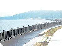
This district is seated in the northwest of Keelung City, and there are docks along the harbor. It provided convenient traffic conditions, and most harbor facilities are built here. The Waimushan Fishing Port has abundant fishery products and fishing is popular there. It is also a good place for overlooking the seascape. This district has considerable tourism resources.
Anle District
- The Anle Community in this district is the first Demonstration Community of National House planned and built in the whole province.
- Chang Gung Hospital is located in this district, providing all-around medical services for the residents in the city and nearby townships.
- The completion of the 1st to 3rd phases of Anle National House and the National Sincheng Community has transformed this district from an agricultural and industrial district to a residential district.
Nuannuan District
Most of the residents have living in this district for several generations, and the population has increased to some degree in recent years. The employers of city government and their families in the dormitories on Guogang Road once predominated in the local population. Recently, thanks to the re-plotting of urban land and the construction of highway interchange, Wanruei Expressway, various public facilities and high buildings, a lot of people have migrated into this district. Houses being built are seen everywhere. It is believed that this district will become the residential area with the most beautiful landscape in the city soon.
Qidu District
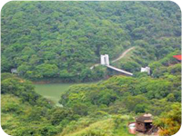
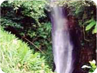
As to the geographic environment of this district, hilly land accounts for 80% and plain land 20%. With an area of 56.2659km2, 42.78% of the territory of Keelung City, this district is the biggest administrative region in the city. It is surrounded by green mountains and beautiful landscapes, and filled with rurality. Keelung River runs from the northeast to the southwest, and meets Shicuokeng, Caolan, Maling, and Yourui Rivers. Mountains prevail in the entire district, and there is some plain area in the Bei-Wu-Du zone in the southwest corner only.
The district covers 20 miles, 412 villages (Changan Village newly set in January 2006), and 18,759 families. The population of the district is 55,230, ranking the third in the city (the total population of the city is 391,553).
- Date of announcement:2021/08/04
- Last updated: 2021/09/11
- Views:4943